Lost password? New user? Register
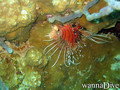
Lizard fish, Philippines. Photo by Stephane Rochon.
Enjoy and contribute!
| Find the best dive sites |
|
|
![]() Mayotte
Mayotte
Africa
Location: Southern Indian Ocean, island in the Mozambique Channel, about half way between northern Madagascar and northern Mozambique
Geographic coordinates: 12° 30' S, 45° 6' E
Coastline km: 185.2 km km
Climate: tropical; marine; hot, humid, rainy season during northeastern monsoon (November to May); dry season is cooler (May to November)
Terrain: generally undulating, with deep ravines and ancient volcanic peaks
Elevation: lowest point: Indian Ocean 0 m
highest point: Benara 660 m
Natural hazards: cyclones during rainy season
Currency: euros (EUR)
Population: 223,765 (July 2009 est.)
Languages: Mahorian (a Swahili dialect), French (official language) spoken by 35% of the population
Capital: Mamoudzou
Divisions: none (territorial overseas collectivity of France)
More details
| Jan | Feb | Mar | Apr | May | Jun | Jul | Aug | Sep | Oct | Nov | Dec | |
|---|---|---|---|---|---|---|---|---|---|---|---|---|
| Climate | ||||||||||||
| Air temp. | ||||||||||||
| Water temp. | ||||||||||||
| Equipment | No sé | No sé | No sé | No sé | No sé | No sé | No sé | No sé | No sé | No sé | No sé | No sé |
| Best season | ||||||||||||
Wanna add some info about Mayotte? Let us know...
This is an interactive map! Use controls to pan and zoom this map.
- Favourite
-
Your favourites and future dive site lists
Dive sites
| Dive sites (3) | Quality | Avg depth | Max depth | Experience | Dive type | ||
|---|---|---|---|---|---|---|---|
| Mtsangamouji | - / - | 13.1 ft | 164 ft | All divers | 


|
||
| Passe bandrélé - Les ancres | - / - | 32.8 ft | 59.1 ft | All divers |
|
||
| Passe en S | 4 / - | 49.2 ft | 82 ft | Don't know | 
|
 Comments
Be the first to comment this country
Errors, Feedback
If you want to add new information or you have found errors on this country, Send us feedback.
Advertise
Wannadive.net 24/24
Wannadive.net on your mobile
![]()
RSS All the RSS feeds of Wannadive.net
Newsletter All news by email