Perdeu a senha?
Novo usuário? Criar uma conta
Big eye, Philippines. Photo by Stephane Rochon.
Aprecie e contribua!
| Achar os melhores sites |
|
|
 Estonia
Europa
Localização: Eastern Europe, bordering the Baltic Sea and Gulf of Finland, between Latvia and Russia
Coordenadas geográficas: 59° 0' N, 26° 0' E
Costa: 3,794 km km
Clima: maritime, wet, moderate winters, cool summers
Relevo: marshy, lowlands; flat in the north, hilly in the south
Cimeiras: lowest point: Baltic Sea 0 m
highest point: Suur Munamagi 318 m
Riscos naturais: sometimes flooding occurs in the spring
Moeda: Estonian kroon (EEK)
População: 1,315,912 (July 2007 est.)
Línguas: Estonian (official) 67.3%, Russian 29.7%, other 2.3%, unknown 0.7% (2000 census)
Capital: Tallinn
Divisão administrativa: 15 counties (maakonnad, singular - maakond): Harjumaa (Tallinn), Hiiumaa (Kardla), Ida-Virumaa (Johvi), Jarvamaa (Paide), Jogevamaa (Jogeva), Laanemaa (Haapsalu), Laane-Virumaa (Rakvere), Parnumaa (Parnu), Polvamaa (Polva), Raplamaa (Rapla), Saaremaa (Kuressaare), Tartumaa (Tartu), Valgamaa (Valga), Viljandimaa (Viljandi), Vorumaa (Voru)
Mais informações
| Jan | Feb | Mar | Apr | May | Jun | Jul | Aug | Sep | Oct | Nov | Dec | |
|---|---|---|---|---|---|---|---|---|---|---|---|---|
| Climate | ||||||||||||
| Air temp. | ||||||||||||
| Water temp. | ||||||||||||
| Equipment | ||||||||||||
| Best season | ||||||||||||
Você quer acrescentar outras informações sobre Estonia? Diga-nos...
Este mapa é interactivo! Use os controles para fazer zoom ou para se deslocar.
- mergulhos (0)
- viagens (0)
- Fotos (2)
- Vídeos (2)
- Compartilhe
- Favoritos
-
Os seus sítios favoritos e as futuras listas de spots
Sites de mergulho
| Sites de mergulho (4) | Qualidade | Profundidade média | Profundidade máxima | Experiência | Tipo de mergulho | ||
|---|---|---|---|---|---|---|---|
| Äntu Sinijärv | - / - | 3 m | 8 m | Para todos os níveis | 

|
||
| Äntu Valgejärv | - / - | 3 m | 5 m | Para todos os níveis |
|
||
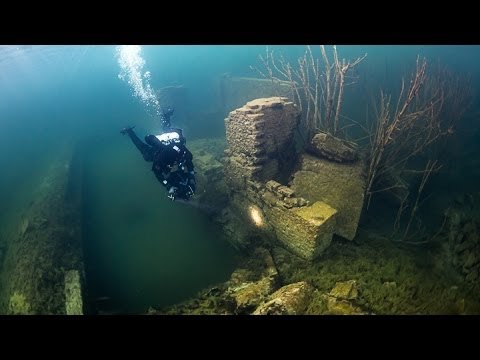
| Hara submarine harbour | 2 / - | 10 m | 12 m | CMAS * / OW | 


|
||
| Rummu Quarry | - / 2 | 15 m | 20 m | Para todos os níveis |
|


 Comentários
Erros, Reacções
Se você quer adicionar novas informações ou se você encontrou erros nesta página, Envie as suas observações