Hai perso la password? Nuovo utente? Registra
Lizard fish, Philippines. Photo by Stephane Rochon.
Divertiti e contribuisci!
| Trova il miglior sito d'immersione |
|
|
 Puerto Rico
America Centrale
Posizione: Caribbean, island between the Caribbean Sea and the North Atlantic Ocean, east of the Dominican Republic
Coordinate geografiche: 18° 15' N, 66° 30' W
Linea di costa km: 501 km km
Clima: tropical marine, mild; little seasonal temperature variation
Terreno: mostly mountains with coastal plain belt in north; mountains precipitous to sea on west coast; sandy beaches along most coastal areas
Altitudine: lowest point: Caribbean Sea 0 m
highest point: Cerro de Punta 1,339 m
Pericoli naturali: periodic droughts; hurricanes
Valuta: US dollar (USD)
Popolazione: 3,927,188 (July 2006 est.)
Lingue: Spanish, English
Capitale: San Juan
Divisioni: none (territory of the US with commonwealth status); there are no first-order administrative divisions, but there are 78 municipalities (municipios, singular - municipio) at the second order; Adjuntas, Aguada, Aguadilla, Aguas Buenas, Aibonito, Anasco, Arecibo, Arroyo, Barceloneta, Barranquitas, Bayamon, Cabo Rojo, Caguas, Camuy, Canovanas, Carolina, Catano, Cayey, Ceiba, Ciales, Cidra, Coamo, Comerio, Corozal, Culebra, Dorado, Fajardo, Florida, Guanica, Guayama, Guayanilla, Guaynabo, Gurabo, Hatillo, Hormigueros, Humacao, Isabela, Jayuya, Juana Diaz, Juncos, Lajas, Lares, Las Marias, Las Piedras, Loiza, Luquillo, Manati, Maricao, Maunabo, Mayaguez, Moca, Morovis, Naguabo, Naranjito, Orocovis, Patillas, Penuelas, Ponce, Quebradillas, Rincon, Rio Grande, Sabana Grande, Salinas, San German, San Juan, San Lorenzo, San Sebastian, Santa Isabel, Toa Alta, Toa Baja, Trujillo Alto, Utuado, Vega Alta, Vega Baja, Vieques, Villalba, Yabucoa, Yauco
maggiori dettagli
| Jan | Feb | Mar | Apr | May | Jun | Jul | Aug | Sep | Oct | Nov | Dec | |
|---|---|---|---|---|---|---|---|---|---|---|---|---|
| Climate | ||||||||||||
| Air temp. | ||||||||||||
| Water temp. | ||||||||||||
| Equipment | Don't know | Don't know | Don't know | Don't know | Don't know | Don't know | Don't know | Don't know | Don't know | Don't know | Don't know | Don't know |
| Best season | ||||||||||||
Ulteriore Mappa

Vuoi inserire alcune informazioni su Puerto Rico? Faccelo sapere
Questa è una mappa interattiva! usa i controlli zoom e pan.
- registro delle immersioni (5)
- viaggi (0)
- Foto (81)
- Video (0)
- Condividi
- Preferito
-
Lista dei tuoi punti d'immersione preferiti e futuri
La tua zona preferita non è nell'elenco? Aggiungi una zona
Zone
| Zone (5) | Siti d'immersione | Sotto zone |
|---|---|---|
| Culebra island | 6 | 0 |
| North and East | 14 | 0 |
| South East | 2 | 0 |
| Vieques island | 2 | 0 |
| West Coast and Mona Island | 6 | 0 |
Siti d'immersione
| Siti d'immersione (1) | Qualità | Profondità media | Profondità massima | Esperienza | Tipo d'immersione | ||
|---|---|---|---|---|---|---|---|
| Peñon de mera | 9 / - | 20 ft | 40 ft | Tutti i subacquei | 

|
 Foto
Foto

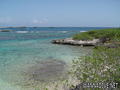
Punta Tamarindo Grande |

Punta Tamarindo Grande |

Punta Tamarindo Grande |
Cayo Icacos |
Dive logs
|
Commenti
Errori, Segnalazione
Se vuoi aggiungere altre informazioni o hai riscontrato degli errori per questo Stato, Scrivi una recensione.
Pubblicità
Wannadive.net 24/24
Wannadive.net sul tuo telefono
![]()
RSS Tutti i RSS feeds di Wannadive.net
Newsletter Tutte le notizie per email